Distance Calculator
Distance from Lindenwold to New York
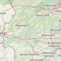
The shortest distance (air line) between Lindenwold and New York is 82.61mi (132.95 km)
The shortest route between Lindenwold and New York is 97.20 mi (156.43 km) according to the route planner. The driving time is approx. 2 h 8 m
How far is it between Lindenwold and New York.
Lindenwold is located in New Jersey, United Statescountry within 39° 49' 2.28" N -75° 0' 36.72" W (39.8173, -74.9898) coordinates. The local time in Lindenwold is 14:47 (12.01.2025)
New York is located in New York, United Statescountry within 40° 41' 39.48" N -74° 4' 30.36" W (40.6943, -73.9249) coordinates. The local time in New York is 14:47 (12.01.2025)
The calculated flying distance from Lindenwold to New York is 82.61miles which is equal to 132.95 km.
If you want to go by car, the driving driving distance between Lindenwold and New York is 97.20 miles (156.43 km). If you ride your car with an average speef of 112 kilometers/hour (70 miles/h), travel time will be 1 hours 24 minutes.Please check the avg.speed travel time on the right for various options
Estimated Travel Time Between Lindenwold and New York
| Average speed | Travel Time |
|---|---|
| 30 mph (48 km/h) | 3 hours 14 minutes |
| 40 mph (64 km/h) | 2 hours 26 minutes |
| 50 mph (80 km/h) | 1 hours 57 minutes |
| 60 mph (67 km/h) | 1 hours 37 minutes |
| 70 mph (112 km/h) | 1 hours 23 minutes |
| 75 mph (120 km/h) | 1 hours 18 minutes |
Lindenwold, New Jersey, United States
Related Distances from Lindenwold
| Cities | Distance |
|---|---|
| Lindenwold to Atlanta | 668.19 mi (1,075.35 km) |
| Lindenwold to Chicago | 677.65 mi (1,090.57 km) |
| Lindenwold to St. Louis | 819.58 mi (1,318.98 km) |
| Lindenwold to Tampa | 921.10 mi (1,482.37 km) |
| Lindenwold to Minneapolis | 995.49 mi (1,602.08 km) |
| Lindenwold to Miami | 1,015.38 mi (1,634.10 km) |
| Lindenwold to Philadelphia | 15.21 mi (24.48 km) |
| Lindenwold to Brooklyn | 79.51 mi (127.95 km) |
| Lindenwold to New York | 82.61 mi (132.95 km) |
| Lindenwold to Queens | 90.00 mi (144.84 km) |
| Lindenwold to Baltimore | 93.49 mi (150.46 km) |
| Lindenwold to Dallas | 1,301.81 mi (2,095.05 km) |
| Lindenwold to Houston | 1,344.14 mi (2,163.19 km) |
| Lindenwold to Denver | 1,579.21 mi (2,541.50 km) |
| Lindenwold to Washington | 125.28 mi (201.61 km) |
| Lindenwold to Phoenix | 2,084.60 mi (3,354.85 km) |
| Lindenwold to Las Vegas | 2,187.52 mi (3,520.47 km) |
| Lindenwold to Riverside | 2,356.26 mi (3,792.03 km) |
| Lindenwold to San Diego | 2,371.98 mi (3,817.34 km) |
| Lindenwold to Seattle | 2,385.39 mi (3,838.91 km) |
| Lindenwold to Los Angeles | 2,405.18 mi (3,870.76 km) |
| Lindenwold to Portland | 2,416.72 mi (3,889.33 km) |
| Lindenwold to San Francisco | 2,529.61 mi (4,071.01 km) |
| Lindenwold to Boston | 266.86 mi (429.47 km) |
| Lindenwold to Detroit | 457.84 mi (736.83 km) |
New York, New York, United States
Related Distances to New York
| Cities | Distance |
|---|---|
| Chicago to New York | 718.27 mi (1,155.95 km) |
| Atlanta to New York | 749.27 mi (1,205.83 km) |
| St. Louis to New York | 878.27 mi (1,413.45 km) |
| Orlando to New York | 942.64 mi (1,517.04 km) |
| Tampa to New York | 1,001.86 mi (1,612.33 km) |
| Minneapolis to New York | 1,020.72 mi (1,642.69 km) |
| Miami to New York | 1,091.55 mi (1,756.69 km) |
| Queens to New York | 7.69 mi (12.38 km) |
| Philadelphia to New York | 79.39 mi (127.77 km) |
| Dallas to New York | 1,372.19 mi (2,208.33 km) |
| Houston to New York | 1,420.65 mi (2,286.31 km) |
| Denver to New York | 1,625.51 mi (2,616.00 km) |
| Baltimore to New York | 171.68 mi (276.28 km) |
| Boston to New York | 184.88 mi (297.54 km) |
| Phoenix to New York | 2,141.27 mi (3,446.04 km) |
| Las Vegas to New York | 2,236.88 mi (3,599.91 km) |
| Seattle to New York | 2,405.80 mi (3,871.76 km) |
| Riverside to New York | 2,408.71 mi (3,876.45 km) |
| San Diego to New York | 2,426.57 mi (3,905.19 km) |
| Portland to New York | 2,442.06 mi (3,930.12 km) |
| Los Angeles to New York | 2,456.66 mi (3,953.62 km) |
| Brooklyn to New York | 3.32 mi (5.34 km) |
| Washington to New York | 205.45 mi (330.64 km) |
| San Francisco to New York | 2,571.87 mi (4,139.03 km) |
| Detroit to New York | 488.50 mi (786.16 km) |


